(click here for a full size jpeg image.(52kB))
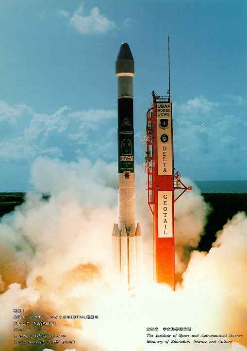
The GEOTAIL satellite was launched on July 24, 1992. The primary purpose of this mission is to study the structure and dynamics of the tail region of the magnetosphere. For this purpose the orbit is designed to cover the magnetotail over a wide range of distances: 8 Re to 210 Re from the earth. This orbit also allows us to study the boundary region of the magnetosphere as it skims the magnetopause at perigees. The orbit in the first year after the launch is illustrated here. The technique of the double lunar swingby is used to keep apogees in the distant magnetotail.
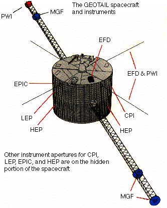
The configuration of GEOTAIL is illustrated above. There are a pair of 100 m tip-to-tip antenna and two 6 m-long masts. The spin axis makes an angle of 87 degrees to the ecliptic plane, and the nominal spin rate is 20 rpm. Data are received at a rate of 64 kbps in the real time mode, and at the same time they are recorded on board at a rate of 16 kbps. GEOTAIL carries seven sets of instruments, which are described in detail here. They measure the magnetic field, electric field, plasma, energetic particles, and plasma waves. Special attention is paid to make the spacecraft electromagnetically clean.
The above article is adapted from the special GEOTAIL issue of the Journal of Geomagnetism and Geoelectricity [1994]. This 'Forward' article was originally written by:
A. Nishida
GEOTAIL Program Manager